05:36 UTC

05:36 UTC

20160911000001,W3ADO-1>BEACON,SGATE,qAS,JA0CAW-6:T#003,122,096,094,133,215,11111111,0010,1

20160911032331,PCSAT-11>BEACON,SGATE,qAR,UA0SNV-1:T#001,099,069,076,094,219,11111111,0000,1

20160911032431,W3ADO-1>BEACON,SGATE,qAR,UA0SNV-1:T#004,159,159,036,209,215,11111111,0011,1

20160911032532,W3ADO-1>BEACON,SGATE,qAR,UA0SNV-1:T#005,037,106,062,037,215,11111111,0000,1

20160911082454,PCSAT-11>BEACON,SGATE,qAR,LA3QMA-6:T#001,100,069,092,079,219,11111111,0000,1

20160911082555,W3ADO-1>BEACON,SGATE,qAR,ON7EQ-10:T#004,159,160,038,209,215,11111111,0011,1

20160911082855,W3ADO-1>BEACON,SGATE,qAR,ESAJ-3:T#007,118,107,088,138,215,11111111,0010,1

20160911114131,W3ADO-1>BEACON,SGATE,qAR,KK4NAM:T#004,159,159,034,210,215,11111111,0011,1

20160911114231,W3ADO-1>BEACON,SGATE,qAR,KK4NAM:T#005,031,102,061,038,215,11111111,0000,1

20160911132525,PCSAT-11>BEACON,SGATE,qAR,KK4NAM:T#001,100,069,065,073,219,11111111,0000,1

20160911151211,W3ADO-1>BEACON,SGATE,qAR,VA3APW-1:T#004,159,160,043,209,215,11111111,0011,1

20160911151311,W3ADO-1>BEACON,SGATE,qAR,KC3ELT-10:T#005,041,104,061,037,215,11111111,0000,1

20160911151511,W3ADO-1>BEACON,SGATE,qAR,VE4GLS:T#007,129,105,095,137,215,11111111,0010,1

20160911233203,W3ADO-1>BEACON,SGATE,qAS,JA0CAW-6:T#001,053,127,062,037,215,11111111,0000,1
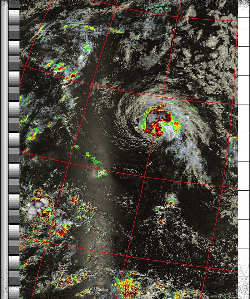
Hurricane Lester was located nearly 600 miles east of Hilo, Hawaii, as of Thursday evening local time. Lester is moving west-northwest, and will continue on this trajectory through Saturday.
 Gradual weakening is expected over the next couple of days.
Robert, NH7WN
12:16 UTC
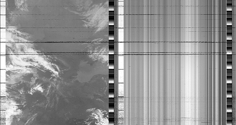
NOAA 19 Northbound 37° E on 137.10MHz, Multi-Spectral Analysis Enhancement, Normal Projection,
Channel A: 2 (Near Infrared), Channel B: 4 (Thermal Infrared)

20160125035729,W3ADO-1>BEACON,SGATE,qAS,JA0CAW-6:T#004,163,163,040,210,215,11111111,0011,1

20160125053616,W3ADO-1>BEACON,SGATE,qAS,JA0CAW-6:T#001,029,096,054,072,215,11111111,0000,1

20160125053716,W3ADO-1>BEACON,SGATE,qAS,JA0CAW-6:T#002,090,068,069,095,215,11111111,0001,1

20160125053813,PCSAT-11>BEACON,SGATE,qAS,JA0CAW-6:T#003,091,072,096,128,218,11111111,0010,1

20160125053816,W3ADO-1>BEACON,SGATE,qAS,JA0CAW-6:T#003,091,069,054,128,215,11111111,0010,1

20160125053916,W3ADO-1>BEACON,SGATE,qAS,JA0CAW-6:T#004,162,162,055,210,215,11111111,0011,1

20160125054016,W3ADO-1>BEACON,SGATE,qAS,JA0CAW-6:T#005,028,095,054,034,215,11111111,0000,1

20160125054442,PCSAT-11>BEACON,SGATE,qAS,JA0CAW-6:T#001,094,065,061,069,218,11111111,0000,1

20160125054448,W3ADO-1>BEACON,SGATE,qAS,JA0CAW-6:T#003,096,075,055,096,215,11111111,0010,1

20160125071549,W3ADO-1>BEACON,SGATE,qAR,9W2JDY-1:T#001,032,148,054,034,215,11111111,0000,1

20160125082019,PCSAT-11>BEACON,SGATE,qAR,LU1WFU-2:T#001,090,065,111,068,218,11111111,0000,1

20160125140527,W3ADO-1>BEACON,SGATE,qAR,EI7IG-10:T#008,162,163,042,210,215,11111111,0011,1

20160125190945,PCSAT-11>BEACON,SGATE,qAR,VE3CEA-10:T#001,093,065,070,072,218,11111111,0000,1

20160125204302,W3ADO-1>BEACON,SGATE,qAR,KF5TJR:T#010,084,066,067,098,215,11111111,0001,1

20160125204810,W3ADO-1>BEACON,SGATE,qAR,KF5TJR:T#002,087,068,072,107,215,11111111,0001,1

20160125205010,W3ADO-1>BEACON,SGATE,qAR,KF5TJR:T#004,162,162,052,210,215,11111111,0011,1

20160125222937,W3ADO-1>BEACON,SGATE,qAR,K6BJ-3:T#010,085,067,071,108,215,11111111,0001,1
20160114092913,W3ADO-1>BEACON,SGATE,qAR,9W2JDY-1:T#008,162,162,040,210,215,11111111,0011,1

20160114220210,W3ADO-1>BEACON,SGATE,qAR,9W2JDY-1:T#001,037,158,064,035,215,11111111,0000,1
Dear Sir/Ma’am,
On 25 November 2015 at approximately 0816z, the JSpOC detected multiple objects in the vicinity of NOAA 16 (#26536>, which may indicate a breakup of the non-operational satellite. As of 1830z, 19 associated objects have been cataloged as analyst satellites, and have been incorporated into the JSpOC’s routine conjunction assessment screenings.
More pieces may be cataloged as analysis continues, and messages will be sent to owner/operators if there is a potential conjunction that is a concern per our standard reporting process.Very Respectfully,
JSpOC Orbital Protection and SSA Sharing Teams

Aloha
I’d swear the storm to our north is “stagnant.” No apparent movement since yesterday. From the perspective I get from the satellites the storm appears much more threatening than what I see on the news. Perhaps they use an orthographic or mercator projection. I should look into that.
Weather here remains pretty much the same. About 91 degs with high humidity. Random downpours and flash floods. Nothing significant in our area yet tho. 73.
Robert, HN7WN
23:38 UTC
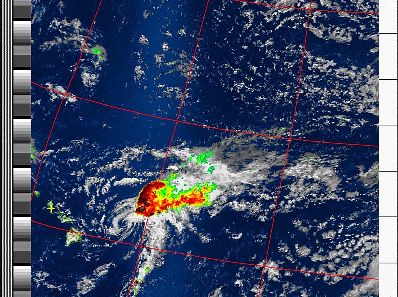
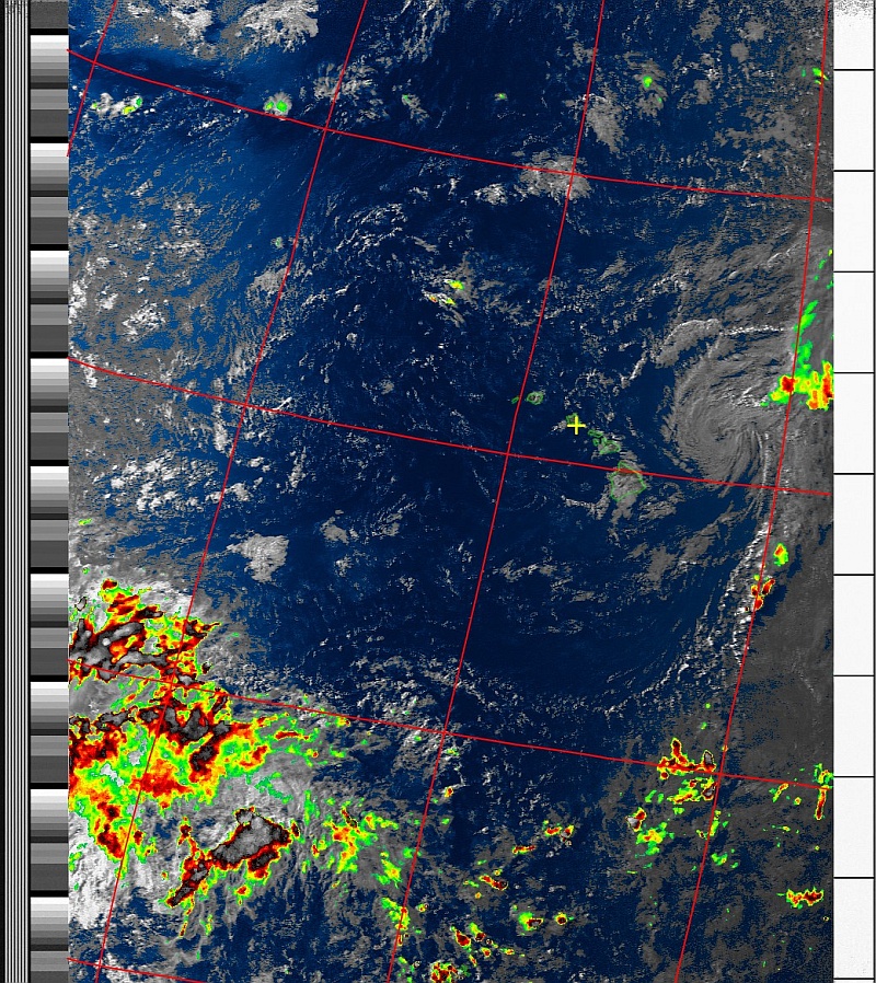
Ignacio still looks threatening to me and what follows doesn’t so nice either.
Hope you all are well and safe., 73.
Robert, NH7WN


Looks to me like is is now moving more southerly but also dying out? Very slow going. Maybe Honolulu tomorrow.
This is the first bird of the day. I will probably just post what I finally end up with on my website, NH7WN.COM later after dinner.
73 Robert NH7WN
One more to go. NOAA 18 westerly in a few minutes. Shud be high enuf to pick up some of the activity. Last good pass of the day. Looks like we might get hit tomorrow by the remnants. 73. Robert
