22:28 UTC


22:28 UTC

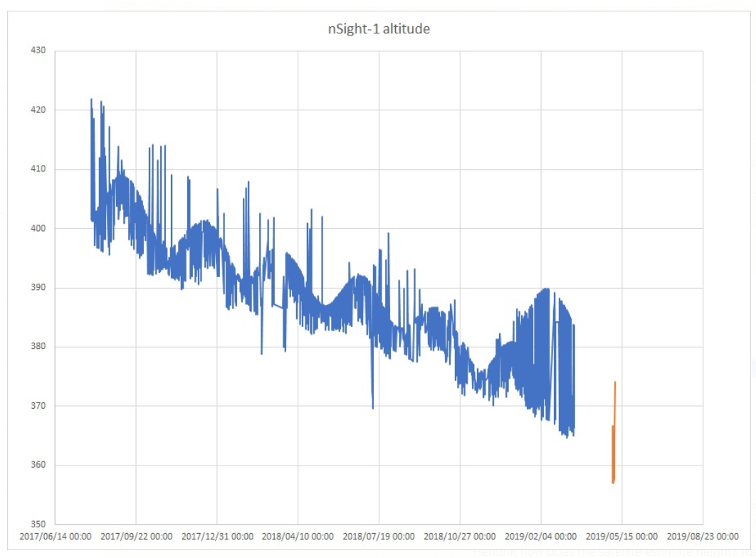
From this plot it can be observed how the satellite height is calculated from the on board ADCS estimator. TLE is uploaded to the satellite and using time it calculates the satellite height that varies between apogee and perigee due to elliptical orbit and also the earth is not perfect sphere. Where there is no data, is where the on board estimator was not on. Satellite is currently at around 360km from >400km start, more than two years ago. Re-entry calculated around next time this year. This will be the last QB50 sat to re-enter launched form the ISS
04:33 UTC

DECAY_EPOCH          WINDOW   REV    DIRECTION   LAT    LON    INCL   NEXT_REPORT
2019-03-07 07:03:00  17       7394   ascending   45.1   236.3  51.6   0
2019-03-07 07:18:00  55       7394   descending  37.7   322.4  51.6   0
2019-03-07 05:48:00  55       7393   descending  46.2   327.9  51.6   2
2019-03-07 06:41:00  180      7393   ascending   -19    173.8  51.6   6
2019-03-07 08:57:00  300      7395   descending  4.8    331    51.6   12
2019-03-07 08:22:00  540      7397   ascending   24.5   184.8  51.6   24
2019-03-07 08:24:00  840      7396   ascending   30.3   190.7  51.6   48
2019-03-07 06:51:00  1140     7396   ascending   19.6   203.2  51.6   72
DECAY_EPOCH          WINDOW   REV    DIRECTION   LAT    LON    INCL   NEXT_REPORT
2019-02-16 17:48:00  33       9910   ascending   49.5   177.6  51.6   0
2019-02-16 17:48:00  33       9910   ascending   49.5   177.4  51.6   0
2019-02-16 18:01:00  120      9910   descending  35.7   252    51.6   2
2019-02-16 18:21:00  120      9912   descending  -26.2  304.3  51.6   6
2019-02-16 19:22:00  300      9911   descending  49.4   198.8  51.6   12
2019-02-16 22:17:00  600      9913   descending  50.8   146.1  51.6   24
2019-02-16 20:12:00  900      9911   ascending   -37.9  35.3   51.6   48
2019-02-16 15:21:00  1080     9909   descending  -17.9  342    51.6   72
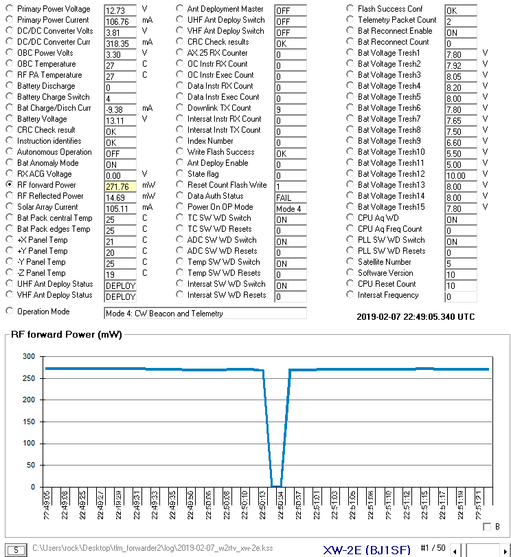
 modulation not so good